Dave Akerman has managed to capture high-quality images of the Earth at an altitude of 38.9 km. with a weather balloon equipped with a Raspberry Pi and a camera.
A few weeks ago, we devoted an article to the PhoneSat mission, a trio of smartphones dubbed «Alexander», «Graham» and «Bell» turned into new NASA microsatellites. The objective of this mission was to reconstruct high-resolution images of the Earth from images captured by 3 smartphone cameras and their subsequent delivery by radio signal to several Earth stations, where hundreds of radio amateurs helped decode data packets from the satellites.
This time the mission isn’t by NASA, but by Dave Akerman who intends to send a foam replica of the Raspberry Pi logo into space equipped with a camera to capture images of the Earth. The target set for this particular feat was to capture images at an altitude greater than 40 km. The launch was scheduled for last April through a balloon inflated with hydrogen, but wind predictions were not favourable for a flight such as this with a sea landing. Nevertheless, Akerman decided to forge ahead, taking advantage of the media coverage of the launch, along with Eben and Liz, members of the Raspberry Pi Foundation. To do this, Dave built a more suitable container for this occasion equipped with a floatation device and kept the original container for a future release.
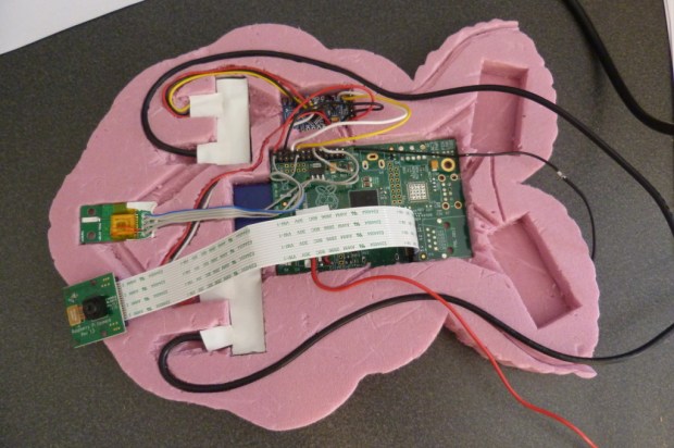
Although the flight was pretty good and it was the first experiment of its kind with the new Raspberry Pi camera, the overall success rate of the mission was not as good as hoped. The reason was that the solid cloud cover made it difficult to get the right exposure to capture sharp, quality images and there was also a technical error in the capture settings for lighting conditions that had not been foreseen at the time. As Akerman says in his blog, because he was unable to control the camera remotely, many of the images appeared burned by indirect reflections while they were pointed to the blackness of space. Nevertheless, live images unique to this type of flight were captured, some of which were of the highest quality.
For the next flight, Akerman took note of the mistakes made in the previous launch and prepared all the material, waiting until the wind predictions were optimal for launch. In order to avoid the technical problems of the previous launch, the latest Pi camera software was updated for configuration in matrix metering mode and the software was programmed to capture 3 types of images per minute: small images be sent to a first radio channel, medium sized images to be sent to a second radio channel and high quality images to be stored in the camera’s SD card. As in the PhoneSat mission, the images sent by the Pi camera were recorded using radio frequency signals by a large number of radio amateurs who worked as volunteers to decode the images.
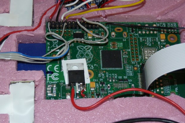
The preparations for the balloon were fairly simple. The foundation’s logo-shaped foam case was closed. It housed the Raspberry Pi, Pi camera and satellite tracker, along with the battery that powers the system. The balloon was attached to the Raspberry Pi for ascent and the parachute was attached for descent. In this case, and given the wind gusts, the release point was changed to avoid landing near Bristol.
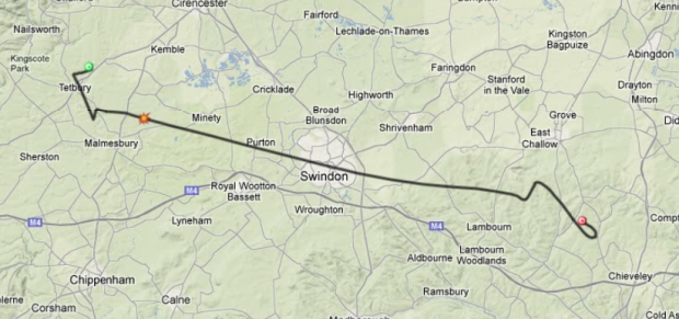
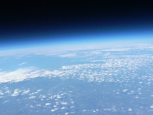
Following the release and with a planned flight time of 3 hours, the expected flight path showed an itinerary before landing of at least an hour by car, in part because at launch time the wind speed fell and the device landed ahead of schedule. After recording the images received, it seems that this time the Pi camera matrix metering and the good weather gave the expected results, capturing high quality images even in the low-resolution images recorded on the first channel. One of the images stored on the card was taken at an altitude of 38.9 kilometres, more or less in the same position where the device was recovered.
On this occasion, the selfless participation of radio amateurs who recorded the images sent was excellent, despite Akerman using a very high transmission rate that limits the frequency range. The two radio signals enabled for recording the images were received in Northern Ireland, the Netherlands and even France.
Dave Akerman’s and his Raspberry Pi balloon’s feat show, with some technological limitations, that low-cost missions like the balloon or PhoneSat using Raspberry Pi technology make it possible to reach limits that were unthinkable only a few years ago.
Images | Dave Akerman


